
Polish Tatras (Tatry Polskie)
winter map
)
scale
legend
size
1st edition
author
publishers
ISBN
1:25 000
6 languages
132 x 88 cm
1999
Michael Siwicki
83-87873-03-9 978-83-7499-008-0

distribution
![]()
review PL
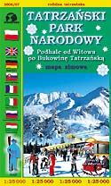
Winter map of Polish Tatras in 1:25 000 scale is the adaptation of a map of TNP in the same scale. It has been published on the order of Candidature Commitee Zakopane 2006, preparing an offer for organizing Winter Olympic Games.
The set of signs has been re-elaborated for the purposes of winter map. Tourist routes are drawn below top forest line only. Chair-lifts and ski-lifts are clearly marked as well as danger of avalanches signs. Vivid blue hill shading and rocks distinctly show the relief. Pictograms of planned games are curios element of this map.
On back side you can find animals' tracks on snow and winter panoramas. There is a map of ski-lifts and extensive bilingual directory.