Atlas of Tatras

scale
legend
size
1st edition
author
publishers
ISBN
1:25 000 and others
2 languages
22,5 x 33 cm
2005
Michael Siwicki
83-87873-73-X
distribution
Dear Reader!
On more then 100 pages you will find, among others:
![]() detailed maps in 1:25 000 scale,
detailed maps in 1:25 000 scale,
![]() comprehensive set of text informations
about the mountains
comprehensive set of text informations
about the mountains
![]() hundreds of photos, among others valleys
from the air,
hundreds of photos, among others valleys
from the air,
![]() several
thematical maps showing new themes,
several
thematical maps showing new themes,
![]() index
of thousands of geographical names.
index
of thousands of geographical names.
That's the first such atlas of Tatras gathering so much informations in one volume.
general map
thematical map
detailed map
index of names
Key to map sheets 1:25 000 scale

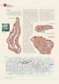
Atlas of Tatras, besides thematical maps in the directory, contains first of all maps in 1:25 000 scale, covering whole ridge and several settlements around. They are very detailed, with colour hill shading, full of geographical names, unparalleled to any existing works. Atlas identically treat Polish and Slovakian part.
Pages of the atlas correspond to the valleys, giving almost complete information about them and surrounding peaks. The pages are enhanced with hundreds of brilliant photos. There is geographical net in the background suitable to identify objects, in index too.
Besides the maps in main scale there is detailed map of Orla Perć (Eagle Path) in 1:5 000 scale here as well as city-maps in 1:15 000 scale.
© Zakład Kartograficzny Sygnatura, Wydawnictwo Kartograficzne Polkart


