
Polish Tatras (Tatry Polskie)
)
scale
legend
size
1st edition
author
publishers
ISBN
1:30 000
3 languages
93 x 61 cm
2001
Michael Siwicki
978-83-87873-43-1 978-83-7499-009-7

distribution
![]()
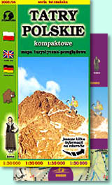
A map of Polish Tatras, thanks to smaller scale 1:30 000 has not so big size and is very simple to use. It has warm colours of contour lines, rocks and vegetation.
The explanation contains about 80 signs described in 3 languages (PL, GB, D). Touristic routes are very clear, close to mountain huts we have put their pictures. Rocks and hill shading on very high level, as usual on our maps. There are plenty of names and symbols here.
On back side you can find geographical directory and details about mountain huts. There is a great 3D panorama of Polish Tatras as well as schema of touristic routes. Several photos and funny cliparts of people and animals make back side attractive.