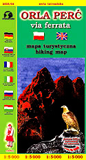
Eagle Path (Orla Perę)
via ferrata

scale
legend
size
1st edition
author
publishers
ISBN
1:5 000
8 languages
82 x 56 cm
2003
Michael Siwicki
83-87873-42-X
distribution
A map of Eagle Path in 1:5 000 scale is an extraordinary map, thanks to great scale and very specific region it covers. Eagle Path is real via ferrata, with plenty of chains and ladders. It's map is bilingual - Polish-English.
The explanation contains many signs, described in 8 languages (PL, GB, D, RUS, SK, F, I, H). Vivid hill shading in two colours, rocks and 5-m contour lines clearly show the relief. The routes are particularly detailed drawn, several points have geographical co-ordinates described - for GPS.
There are diagrams of stretches on a map, enriched with summaries of descents and climbs.
On back side you can find description of the route, necessary equipment, mountain shelters, cross-section, panoramas and a map showing possibilities of reaching Eagle Path.


